Dates of Trip: 7 December 2008
Climbers: hobo and tortoise
Location: Clear Creek County, CO, USA
Trailhead: Loveland Pass
Summit: 13234 feet
Starting Ele: 11990 feet
Ele. Gain: 1244 feet
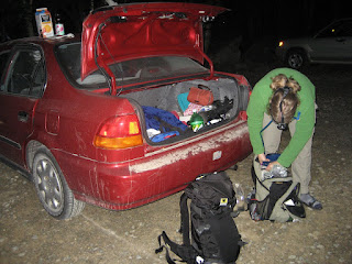
Quick trip to reacclimate to winter climbing in CO. Strong wind, typical of Loveland Pass area. Snow pack was solid and windblown, so no snowshoes needed. Steered clear of some gnarly cornices and no ice axes needed either.
Sunday, December 7, 2008
Sunday, October 26, 2008
Attempt on Fletcher Mountain
Dates of Trip: 26 October 2008
Climbers: hobo and tortoise
Location: Mosquito Range, CO, USA
Trailhead: Blue Lakes
Summit Objectives: Fletcher Mountain


Climbers: hobo and tortoise
Location: Mosquito Range, CO, USA
Trailhead: Blue Lakes
Summit Objectives: Fletcher Mountain


Saturday, September 6, 2008
Blanca Peak
Dates of Trip: 6-8 September 2008
Climbers: hobo and tortoise
Location: Sangre de Cristo Range, CO, USA
Trailhead: Lake Como Road
Summit Objectives: Blanca and Ellingwood
Summit: Blanca at 14345 feet
Starting Ele: 8100 feet
Ele. Gain: 6245 feet
Distance: 20.0 mile
Day 1: Arrived at Lake Como Road (worst road in Colorado!) around 330p on Saturday after picking Hobo up from COS. The Pontiac made it 2 miles up before having to be cached in a grove of pinons and prickly pears. Left the car and 8100 ft. el. at 4p. Were aiming for Lake Como (~5.0 miles, 11,700 ft el.), but lost the sun and had some fatigue going on, so stopped to pitch the tent at ~4.5 miles, 11,300 ft el.


Day 2: On the trail at 630a. Determined that even though we weren't all that far from Lake Como, we were glad we had stopped where we did the night before. Stopped at Blue Lakes to filter water. Made it over 13000ft (above the ledges, above the gully) before the sun reached us peeking over the east side ridge between Blanca and Ellingwood. All route descriptions say "difficult class 2", but I made several apparently class 3 moves on the ridge to the summit. Summitted around 11a, with a friendly group of Ohioans. Took a break on the descent in the valley with said Ohioans. Contemplated an ascent of Ellingwood, but decided against it due to lateness of hour (1p) and fatigue. Watched some others pick their way up the south face. Reached Lake Como again around 315p. Said goodbye to Ohioans and soaked feet in Lake Como. Back to camp by 530p, asleep by 8.


Day 3: Slept in til 7, packed up, and packed out - 3200ft down "worst road in Colo." At car by 1030a.


Distance and elevation are cumulative.
Sunday, August 24, 2008
Mt. Katadhin
Dates of Trip: 22-24 August 2008
Climbers: hobo and tortoise
Location: Baxter State Park, ME, USA
Trailhead: Helon Taylor
Summit Objectives: Katadhin (Maine High Point)
Total Time: 10.5 hours
Summit: 5267 feet
Ele. Gain: 3410 feet
Distance: 9.8 mile
Car-camped at Katahdin Stream, then drove over to rolling brook trailhead. Ascended via Helon Taylor Trail, traversed the Knife Edge to bag all three Katahdin peaks: Pamola, South, and Baxter. Descended via Saddle (steep and LONG). Spotted a moose feeding at Chimney Pond. Tortoise's first class III!


Saturday, August 9, 2008
Grays and Torreys
Dates of Trip: 8-9 August 2008
Climbers: hobo and tortoise
Location: Front Range, CO, USA
Trailhead: Grays Peak
Summit Objectives: Edwards, Grays and Torreys
Total Time: 8.0 hours
Summit: Grays at 14270 feet, Torreys at 14267 feet
Starting Ele: 11280 feet)
Ele. Gain: 3600 feet
Distance: 8.3 mile
Camped at Grays Peak Trailhead with about 8 other parties, including a drunk one that stayed up loudly until 12:45am. Got up at 3:30a after a rather uncomfortable night of sleep. On the trail by 4am. Meant to head south to high 13er, Mt. Edwards, but got a bit confused and shoved off for the 14ers instead. Summitted Grays at 7:30a, followed by Torreys at 8:30a. *Massive* crowds of people of which I'd never seen the like on a mountain. Briefly considered making a run at Edwards at the end, but decided against, based on lateness of hour, weather observation, and tiredness. Back at parking by noon. Gnarly drive up and down the access road, but the Pontiac made it again. It's an off-road vehicle at heart. Got home and took solid 2hr nap.


Sunday, July 13, 2008
The Great Gulf
Dates of Trip: 11-13 July 2008
Climbers: hobo and tortoise
Location: Presidential Range, NH, USA
Trailhead: Six Husbands
Summit Objectives: Jefferson, Adams, Madison
Total Time: 10.0 hours
Summit: Adams at 5774 feet, Jefferson at 5712 ft, Madison at 5366 ft
Starting Ele: 1412 feet
Ele. Gain: 5300 feet
Distance: 10.0 mile
Packed in 4 miles up the Great Gulf trail to the Six Husbands/Wamsutta Junction and camped at an established site just beyond. Struck out along Six Husbands by 7:15, and scrambled up Jefferson's Knee to summit Mt. Jefferson. Then took Gulf Side trail across Edmund's Col to Mt. Adams and summitted. From there, a quick jaunt over to Madison Hut and the Mt. Madison summit. We then descended back to the Grest Gulf via The Buttress trail, arriving back in camp just after 5 pm. After one more night in camp, we packed out with very sore quads and soaked in the Peabody River before heading out. Distance/time listed is for summit day, not including pack-in. Elevation gain is estimated cumulative, including pack in.


Subscribe to:
Comments (Atom)