Showing posts with label fourteeners. Show all posts

Saturday, September 3, 2022

Mt Bierstadt

 Date of Trip: 3 September 2022
Climbers: Travis, Clara, Trevor, and G
Location: Front Range, CO, USA
Trailhead: Guanella Pass
Summit Objective: Mt. Bierstadt
Total Time: 7.0 hours
Summit: Bierstadt at 14,065'
Ele. Gain: 2850 feet
Distance: 7.5 mile


Written by Travis

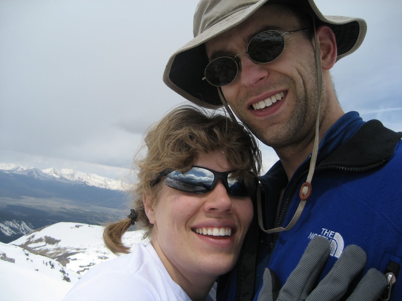
Clara and I headed back to the mountains today to climb 14er Mt. Bierstadt. This time we invited Clara's classmate and carpool buddy G and his dad Trevor. It was Clara's 4th 14er and G's first.  They were both rock stars. 

We arrived at the trailhead at 720am, and sort of amazingly were still able to park fairly close to the trailhead, albeit along the road.  We were on the trail at 730. 

We soon got to see a moose foraging among the willows.  I don't think I've ever seen a moose while climbing a 14er.  To be fair, we wouldn't have seen this one, except some other people had tracked it all morning with a telescope as it wandered from the lake, so we knew where to look.  

We then kept moving through the willows. There are boardwalks now that make it so easy. "Back in my day" finding your way through the willows was literally the crux of the route!  

The trail was packed as usual. Owing to the proximity to Denver, and its relative ease, it's one of the most climbed 14ers. We don't go for solitude.

In addition to my first moose sighting, I also saw my first supplemental oxygen use on a 14er.  You read that right.  A woman was carrying a small canister with a mouth piece as she was slogging up the trail.  I didn't see her use it, but she had it at the ready! (Another guy had one in the pocket of his pack on the way down, kind of like you would carry bear spray.) Now mind you, I just had a friend from MIT climb K2 --  the second tallest mountain in the world, literally twice as high at 28,000' -- WITHOUT SUPPLEMENTAL OXYGEN. But here we are.  

We kept going up. The kids started slowing down, so I busted out the energy chews (basically gummies for adults). That did the trick. Then we reached the summit ridge, and the Class II to the top began. It's funny how Clara can be dragging, but as soon as we transition from boring hiking to rock scrambling, she finds her next gear. "Dad, can we just do more of this?"

We summited shortly before noon, and commenced celebrating G's first 14er. And Clara's 4th (including 3 within 8 days). 

Even before making it to the top, G had declared his goal of climbing all 58 Colorado 14ers by the time he's 41. He also told us (a few times) that this was "the most wonderful thing he has ever done in his life." 

It took me back to my first time summiting a 14er (Mt Elbert, 2000).  And all the friends of mine who climbed their first 14er on a trip with me.  And how he'll probably remember this day for the rest of his life. And how at this point, that's the stuff I really care about. Me summiting this peak for the 3rd time (or is it 4?) is kind of secondary.

The weather was just about perfect, zero wind, so we hung out for nearly 30 mins. The voice in my head said you know better than this.... 

And sure enough, that voice was soon telling me "I told you so" when it started clouding up big time.  Then it was thundering. We were well on our way down by now, nearly off the eastern shoulder, mostly safe, but it was still unnerving. Clara and I started jogging down the trail. We were back in the willows as it started to rain and then pea-size hail. There was occasional lightning on the ridges around us, none too close. I'll have to add this to the list of peaks I've been stormed off (Holy Cross, Crestone Needle, maybe more)

We made it back to the van at 230pm, 7 hours after setting out. G and Trevor soon followed.


Saturday, August 27, 2022

Grays and Torreys - Travis and Clara

Date of Trip: 27 August 2022
Climbers: Travis & Clara 
Location: Front Range, CO, USA
Trailhead: Grays Peak
Summit Objectives: Grays and Torreys
Total Time: 8.0 hours
Summit: Grays at 14270 feet, Torreys at 14267 feet
Starting Ele: 11280 feet)
Ele. Gain: 3667 feet
Distance: 8.5 mile

Written by Travis


With little more than an hour of planning, Clara and I headed out Friday night for a Daddy-Daughter backpacking-mountainering trip.  We decided we would pack-in for about a mile Friday night, camp, and then attempt to summit two 14,000' peaks on Saturday, Gray's and Torrey's (which are generally considered two of Colorado's easiest 14ers, out of the 58). Amy and the boys were staying home to rest and recover, as the middle school transition, in particular, has not been easy.  
We arrived at the trailhead at 630pm Friday evening in a driving rain. It's been a crazy monsoon summer in the mountains, and there was water flowing everywhere. Worse, it looked like it could keep it up all night. I was considering bailing completely, or at least camping in the Tahoe at the trailhead. But after about 45 mins, it did stop. And the forecast was for great weather today, so we set out. 
We made it past the willows and took about the first flattish spot we could find so as to get the tent up before dark.  Few really pack-in on these mountains (easily done in a day) so nobody was around, but there also aren't really any established sites. It was in the 40s and damp (very un-Colorado!) Clara was cold so we got her in the tent and into a sleeping bag while I cooked dinner just outside the vestibule.  I then filled her Nalgene bottle with boiling water to take to bed, a trick which she thought was amazing.  
The GPS said we were at 12,000'.  I remembered that I never sleep well at 12,000'. This trip was no exception.  We were about 100' off the trail, so we had people walking by shining headlamps at us, and talking, starting at 330am.  I cancelled the alarm I had set for 6, but at 645a, I figured we should get up. Clara said she didn't really feel like climbing a mountain, because of the bad night of sleep. I said, yeah, that's kind of how mountaineering goes. I never sleep well the night before a climb.  Amy and I have a saying, "the best days on the mountain often follow the worst nights".  
Well, she decided she'd give it a go. But only if we had some ramen for breakfast. Deal! I cooked it without leaving my sleeping bag. (It was 30s outside, ice on the tent fly, and the light rain that fell on us was apparently snow up on the mountain).  
We joined the conga line marching past us on the trail at 715am.  We stopped to filter water at the first stream access around 745 (we could hear the water at our hastily chosen campsite, but it was maybe a couple hundred yards away, so we used what I packed in).  
We headed on up to Gray's Peak.  I always do Gray's first for some reason -- maybe because it's Gray's and Torrey's, not Torrey's and Gray's? Clara kept saying she didn't think she wanted to do Torrey's too, so I kept reminding her to focus on the goal of Gray's and that we'd worry about Torrey's later.  We passed the mountain goats in their usual spot on the shoulder toward Edwards. It was a mamma and a kid. Clara also counted 7 pikas on the day. 
Eventually we summited Gray's. The trace of snow and ice had mostly turned to slush by now, so no big deal.  The weather was great as forecast, just some typical wind.  
Gray's was Clara's 2nd 14er, having done Sherman with Amy in 2020. (I had taken the boys back to the car as we feared Nate might be literally blown off the mountain that day.) Anyway, Clara was amazing. She was not the youngest on the summit though as there was a 9 year old girl tagging her 3rd 14er (she had just come over from Torrey's). 
We took some pics (including with the provided signs and brick, lol) and headed down to the saddle between the peaks.  I was pretty sure a little downhill would have Clara ready to go up again and indeed that was the case.  I told it her it always looks harder than it really is. She actually thought Torrey's was easier, because there are less switchbacks, just UP. More pics with provided signs and brick. (I'm so old that I remember when you had to try to remember what mountain you were on in each summit pic!)


We headed down, collecting my cached backpack at the saddle, then the water filter at the stream, before arriving at the tent. The crowds had mostly dissipated by now, but the weather was still perfect. Probably 50's at the tent, with an intense sun. Clara asked for a post-climb snack of mashed potatoes, so I whipped them up before packing up camp. Then we headed out the final 1 mile, getting to the truck at about 3 I think. Did I mention I was exhausted? Maybe this is how I always felt at the end of a day of 14ers, hard to say. Overall, it was a fantastic trip. Clara did her first overnight mountaineering trip and got her 2nd and 3rd fourteeners, and her first "two-fer". I can't be more proud of her. She's learning what it's like to carry a pack, be cold, sleep like crap, and yet that climbing mountains mostly boils down to putting one foot in front of the other, over and over again. I think I got my third climb of G-T (first with my buddy Terry in 2000 then with Amy in 2008 when we missed the turn to 13er Mt Edward's and "settled" for G-T. Maybe more, but that's what I remember at least.) And my first 14er summit in 7 years, my first fourteener post ACL tear #2, and first 14er in my 40's. Still at 42 of 58 overall I think but it's not really about me these days and that's just fine. 8.5 miles round trip. 3667' of elevation gain Clara's wildlife count: 7 pikas 2 mountain goats 2 chipmunks Couple dozen dogs, some of which were even on a leash One injured dog being carried down in a backpack Too many humans to count

Saturday, August 28, 2010

San Luis Peak

Dates of Trip: 28 August 2010
Climbers: hobo and tortoise
Location: San Juan Range, CO, USA
Trailhead: West Willow Creek
Summit Objectives: San Luis
Summits: San Luis Peak at 14019 ft
Starting Ele:  11500 ft
Ele. Gain:  ~3700ft
Distance:  11 mi

We drove out to the old mining town of Creede after work on Friday - a gorgeous drive.  We drove up the box canyon just north of Creede in the dark, the old mine ruins looming in the shadows.  We camped at what we thought was the trailhead and had a very pleasant night.

In the morning we discovered we were about a half mile from the trailhead, so we followed the other 14er baggers (not *too* many, as this is a non-standard route) to the trailhead at the end of the road and got on the trail.

This is a long-ish hike, as many in the San Juans are, but gentle and very scenic, cresting two passes before the summit push and contouring around their valleys.  There is a very disappointing section of significant elevation loss after the first mile or so, but other than that, it's very satisfying.

We made good time to the summit and spent about 20 minutes there, eating lunch and chatting with other hikers, and then rather suddenly, the sky started to cloud up and the temperature dropped.  There were still people on their way up, but we took the opportunity to drop down, quickly.  We got a few spatters of rain, but nothing too serious.  Still, we were in a hurry to get to a safer elevation and more protected area.

I got rather fatigued toward the end (which I'm blaming on being 5 weeks pregnant), which made the push back up that segment about a mile from the trailhead quite a slog, but I made it.  It was a really fun hike.

We ate dinner at a hippy burger joint in Creede before driving home that evening.


Saturday, September 6, 2008

Blanca Peak

Dates of Trip: 6-8 September 2008
Climbers: hobo and tortoise
Location: Sangre de Cristo Range, CO, USA
Trailhead: Lake Como Road
Summit Objectives: Blanca and Ellingwood
Summit: Blanca at 14345 feet
Starting Ele: 8100 feet
Ele. Gain: 6245 feet
Distance: 20.0 mile

Day 1: Arrived at Lake Como Road (worst road in Colorado!) around 330p on Saturday after picking Hobo up from COS. The Pontiac made it 2 miles up before having to be cached in a grove of pinons and prickly pears. Left the car and 8100 ft. el. at 4p. Were aiming for Lake Como (~5.0 miles, 11,700 ft el.), but lost the sun and had some fatigue going on, so stopped to pitch the tent at ~4.5 miles, 11,300 ft el.


Day 2: On the trail at 630a. Determined that even though we weren't all that far from Lake Como, we were glad we had stopped where we did the night before. Stopped at Blue Lakes to filter water. Made it over 13000ft (above the ledges, above the gully) before the sun reached us peeking over the east side ridge between Blanca and Ellingwood. All route descriptions say "difficult class 2", but I made several apparently class 3 moves on the ridge to the summit. Summitted around 11a, with a friendly group of Ohioans. Took a break on the descent in the valley with said Ohioans. Contemplated an ascent of Ellingwood, but decided against it due to lateness of hour (1p) and fatigue. Watched some others pick their way up the south face. Reached Lake Como again around 315p. Said goodbye to Ohioans and soaked feet in Lake Como. Back to camp by 530p, asleep by 8.


Day 3: Slept in til 7, packed up, and packed out - 3200ft down "worst road in Colo." At car by 1030a.


Distance and elevation are cumulative.

Saturday, August 9, 2008

Grays and Torreys

Dates of Trip: 8-9 August 2008
Climbers: hobo and tortoise
Location: Front Range, CO, USA
Trailhead: Grays Peak
Summit Objectives: Edwards, Grays and Torreys
Total Time: 8.0 hours
Summit: Grays at 14270 feet, Torreys at 14267 feet
Starting Ele: 11280 feet)
Ele. Gain: 3600 feet
Distance: 8.3 mile

Camped at Grays Peak Trailhead with about 8 other parties, including a drunk one that stayed up loudly until 12:45am. Got up at 3:30a after a rather uncomfortable night of sleep. On the trail by 4am. Meant to head south to high 13er, Mt. Edwards, but got a bit confused and shoved off for the 14ers instead. Summitted Grays at 7:30a, followed by Torreys at 8:30a. *Massive* crowds of people of which I'd never seen the like on a mountain. Briefly considered making a run at Edwards at the end, but decided against, based on lateness of hour, weather observation, and tiredness. Back at parking by noon. Gnarly drive up and down the access road, but the Pontiac made it again. It's an off-road vehicle at heart. Got home and took solid 2hr nap.


Sunday, June 10, 2007

Mt. Buckskin

Dates of Trip: 10 June 2007
Climbers: hobo and tortoise
Location: Ten Mile/Mosquito Range, CO, USA
Route: Kite Lake TH, Northeast slope
Summit Objectives: Buckskin
Summit: 13865 feet
Starting Ele: 3659 meter (12000 feet)
Ele. Gain: 595 meter (1950 feet)

Used ice axes, no snowshoes. Learned to GLISSADE!!


Sunday, May 20, 2007

Sherman/Gemini

Dates of Trip: 20 May 2007
Climbers: hobo and tortoise
Location: Mosquito Range, CO, USA
Route: Fourmile Creek
Summit Objectives: Sherman, Gemini
Summit: Sherman at 14036 feet, Gemini at 13951
Starting Ele: 3659 meter (12000 feet)
Ele. Gain: 793 meter (2600 feet)
Distance: 11 km (7.0 mile)

Snowshoes required for the soft snow in the midday hours.